-
Our Community
-
- Welcome Visitors About Durham's Community Climate Remembrance Project Diversity Welcome Statement Life in Durham Places to Stay Places to Eat Places to Park Transportation Schools Oyster River School District Welcome New Homeowners
- Durham Public Library Programs & Events Trails and Town Lands Conservation Commission Land Stewardship Conservation Lands & Parks Conservation Easements Trails Youth Organizations University of New Hampshire Durham Preservation Durham Historic Association
- Volunteer Town of Durham Land Stewardship Public Library UNH Cooperative Extension Churchill Rink Parks & Recreation Recreation Program Calendar Outdoor Recreation Activities Outdoor Recreation Sites Sustainable Durham Recycling Information Swap Shop Information Earth Day 2023
-
- Doing Business
-
Inside Town Hall
-
- Departments Assessing Building Business Office Code Enforcement Information Technology Planning Town Clerk/Tax Collector Parks & Recreation Boards, Commissions & Committees Agricultural Commission Conservation Commission Historic District/Heritage Comm. Other Boards & Committees Planning Board Zoning Board
- DCAT Media Productions DCAT Media - Programming DCAT Media Livestream Zoom Video Meeting Schedule Town Council Town Administration Public Hearings Public Safety Police Fire McGregor Memorial EMS (Ambulance)
- Public Works Engineering Division Operations Division Sanitation Division Water Division Wastewater Division Stormwater Town Directory Telephone Directory by Department Services Directory
-
-
Helpful Resources
-
- Quick Links Assessors Online Database Bids and RFP’s DCAT Media Productions GIS Digital Maps Jobs Online Services Parking Information Social Services Town Holidays Trash Pick Up Holiday Schedule Transfer Station & Recycling Center Information Curbside Refuse Collection by Street Zoom Video Meeting Schedule
- Town Documents Budget & CIP Forms & Applications Master Plan Tax Increment Finance (TIF) Districts Tax Maps Town Charter Town Code Town Reports Town Wide Master Fee Schedule Zoning Ordinance Voter Information
- Contact Us Cemetery Information Social Media Facebook Twitter Town Newsletter Friday Updates Town Meetings & Events Agenda and Minutes Calendar Public Hearing Notices State & U.S. Representatives
-
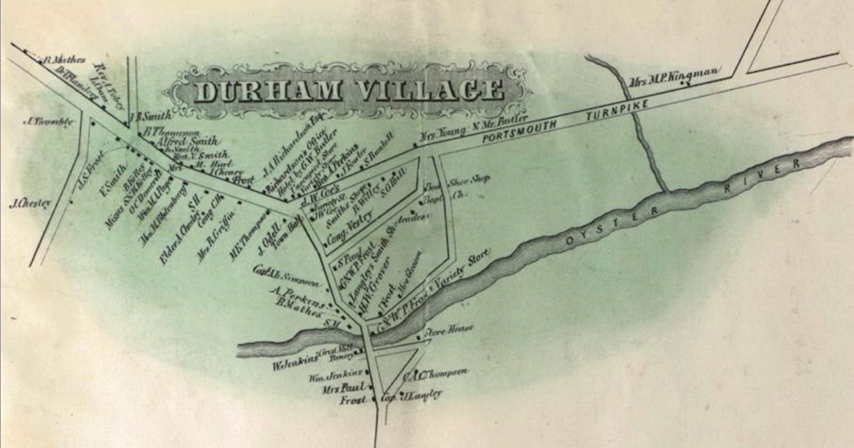
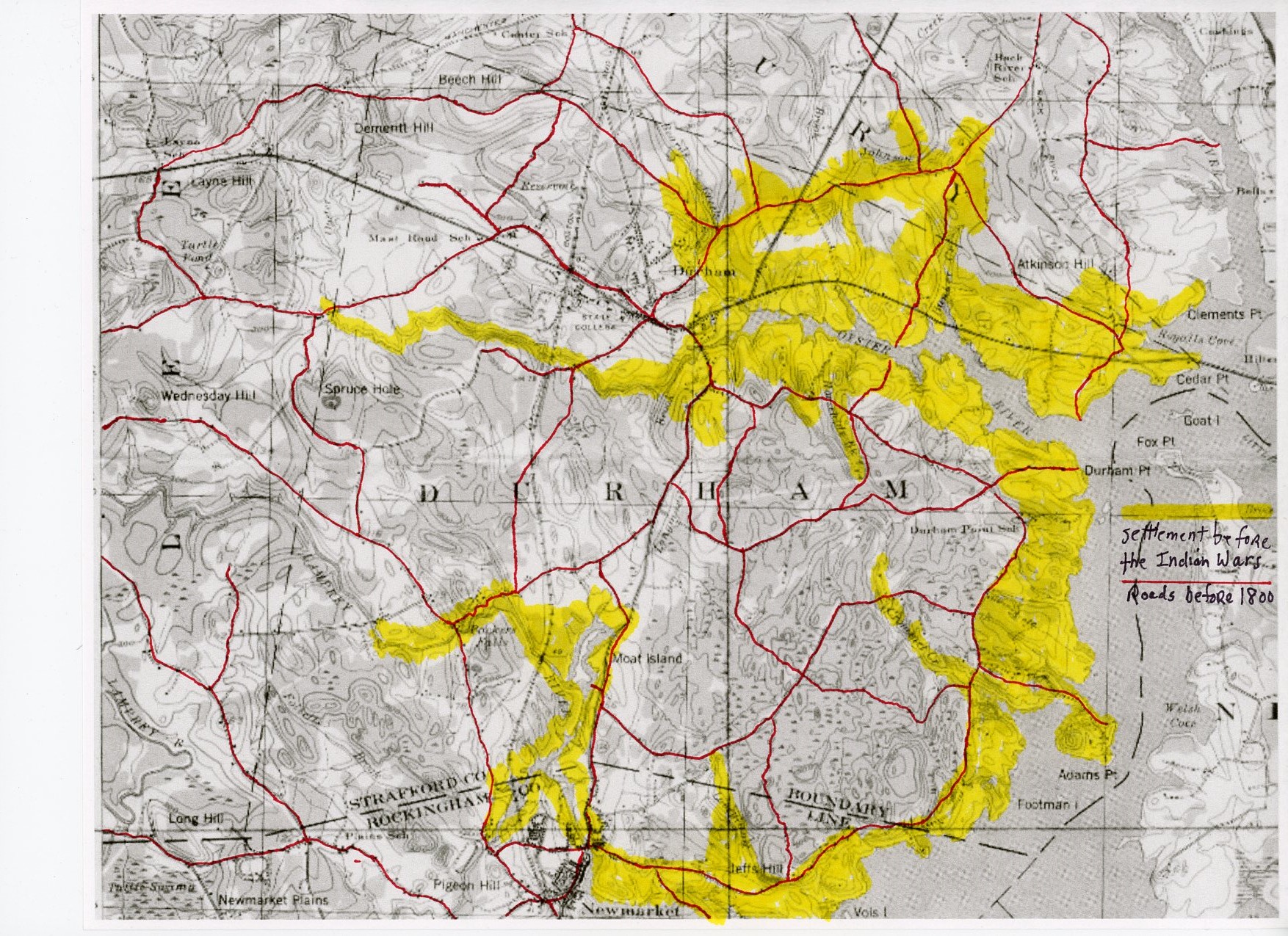
Maps
*PLEASE NOTE. We recently updated all of the parcel data town wide. This new data is incorporated into the Town’s GIS (Geographic Information System) which can be accessed here: https://todnh.maps.arcgis.com/apps/webappviewer/index.html?id=e428d7362b0240baa3a5ca49a8ce6602. Most of the maps shown below are based on the old parcel data and thus are not authoritative. Both maps which depict lot lines and many which do not depict lot lines contain inaccuracies (Some also use the old Map and Lot numbers). These maps are provided since they still offer much valuable information. The maps will be updated to tie in to the new parcel data in the future as resources allow. Please contact the Town Planner with any questions.