-
Our Community
-
- Welcome Visitors About Durham's Community Climate Remembrance Project Diversity Welcome Statement Life in Durham Places to Stay Places to Eat Places to Park Transportation Schools Oyster River School District Welcome New Homeowners
- Durham Public Library Programs & Events Trails and Town Lands Conservation Commission Land Stewardship Conservation Lands & Parks Conservation Easements Trails Youth Organizations University of New Hampshire Durham Preservation Durham Historic Association
- Volunteer Town of Durham Land Stewardship Public Library UNH Cooperative Extension Churchill Rink Parks & Recreation Recreation Program Calendar Outdoor Recreation Activities Outdoor Recreation Sites Sustainable Durham Recycling Information Swap Shop Information Earth Day 2023
-
- Doing Business
-
Inside Town Hall
-
- Departments Assessing Building Business Office Code Enforcement Information Technology Planning Town Clerk/Tax Collector Parks & Recreation Boards, Commissions & Committees Agricultural Commission Conservation Commission Historic District/Heritage Comm. Other Boards & Committees Planning Board Zoning Board
- DCAT Media Productions DCAT Media - Programming DCAT Media Livestream Zoom Video Meeting Schedule Town Council Town Administration Public Hearings Public Safety Police Fire McGregor Memorial EMS (Ambulance)
- Public Works Engineering Division Operations Division Sanitation Division Water Division Wastewater Division Stormwater Town Directory Telephone Directory by Department Services Directory
-
-
Helpful Resources
-
- Quick Links Assessors Online Database Bids and RFP’s DCAT Media Productions GIS Digital Maps Jobs Online Services Parking Information Social Services Town Holidays Trash Pick Up Holiday Schedule Transfer Station & Recycling Center Information Curbside Refuse Collection by Street Zoom Video Meeting Schedule
- Town Documents Budget & CIP Forms & Applications Master Plan Tax Increment Finance (TIF) Districts Tax Maps Town Charter Town Code Town Reports Town Wide Master Fee Schedule Zoning Ordinance Voter Information
- Contact Us Cemetery Information Social Media Facebook Twitter Town Newsletter Friday Updates Town Meetings & Events Agenda and Minutes Calendar Public Hearing Notices State & U.S. Representatives
-
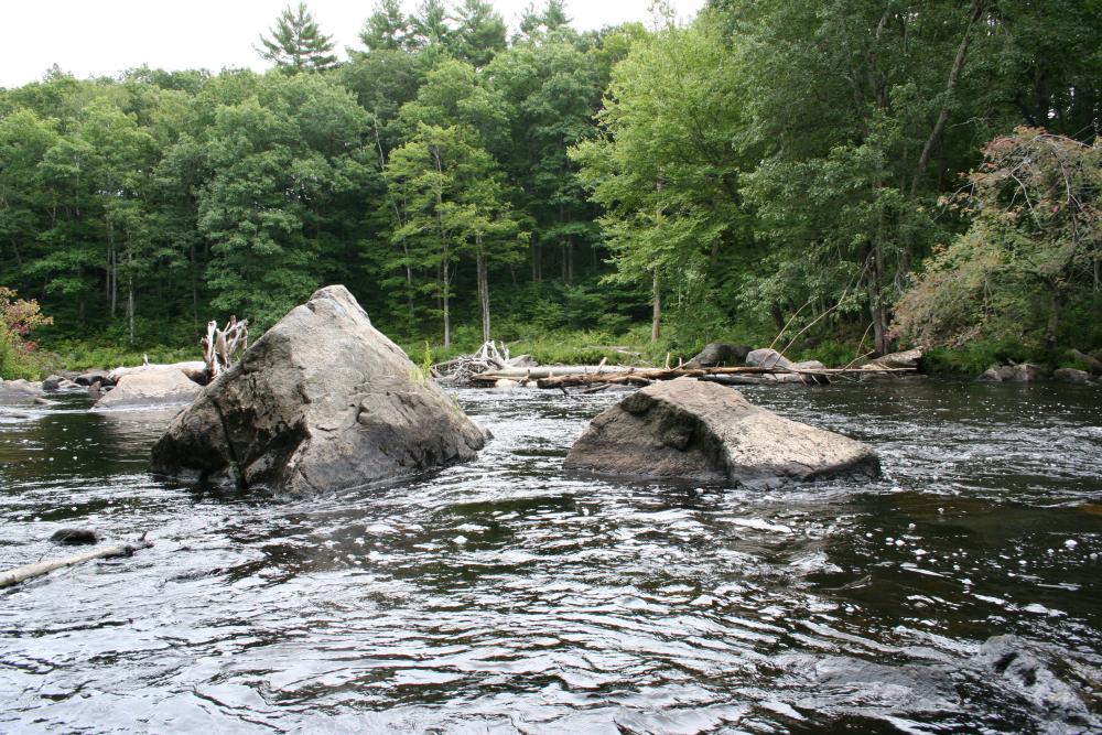
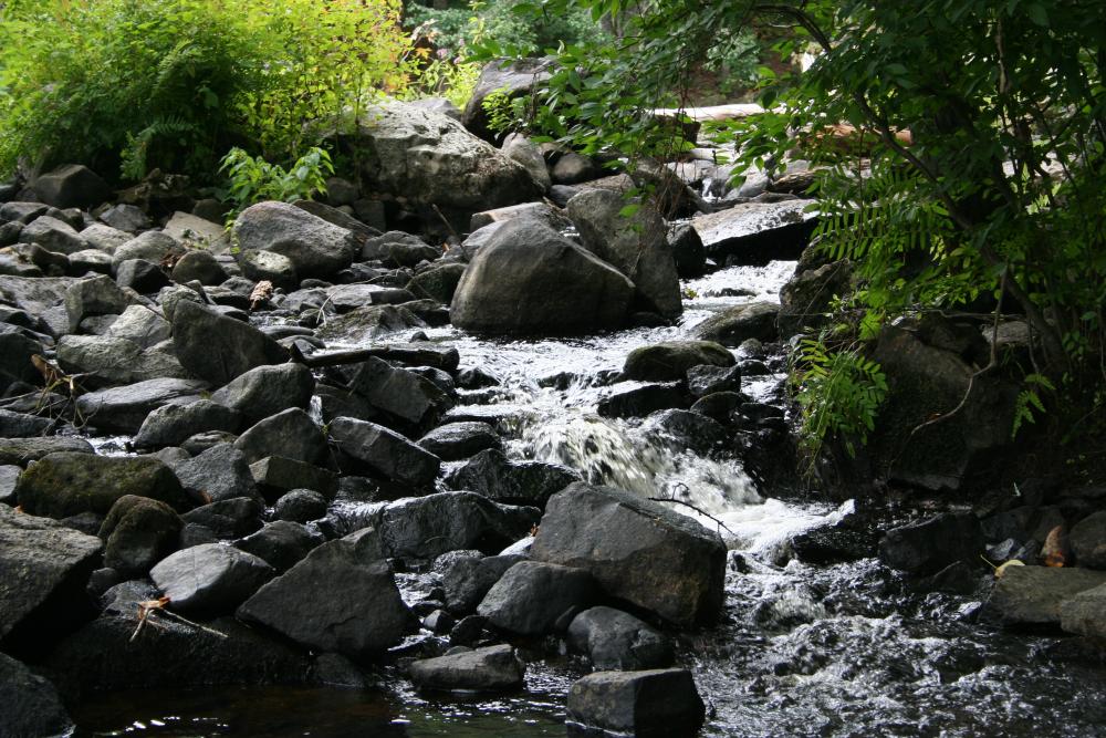
Packers Falls Park
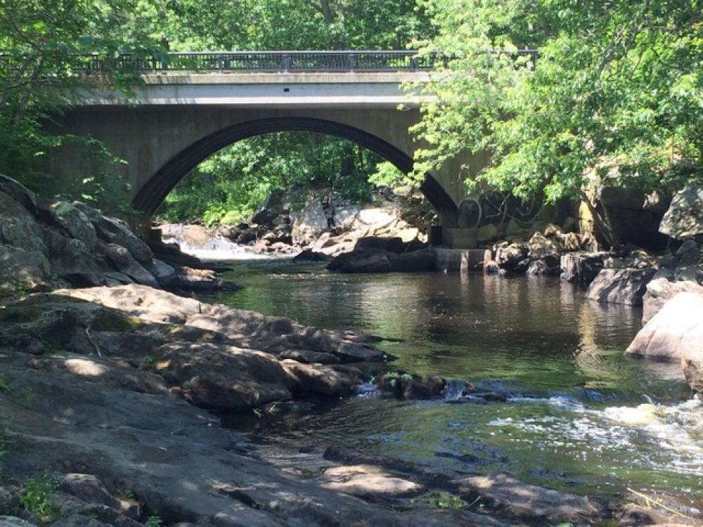
Packers Falls Road | 2.3 acres
DIRECTIONS: From the Durham Town Hall take Route 108 south 1.4 miles. Take right onto Bennett Road. Follow 1.6 miles. Just before junction with Packers Falls Road. a small parking area is on the left. Google map
Packers Falls Park Map and Property Summary
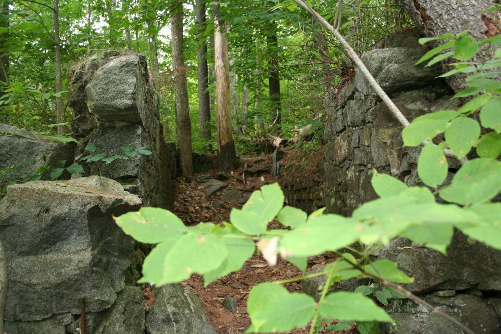
ABOUT THE PROPERTY:
Located at the intersection of Packers Falls Road and Bennett Road, below bridge, both sides of the Wild & Scenic Lamprey River. Parking area for 5-6 cars along Bennett Road. The bridge on Packers Falls Road across river provides pedestrian access to both sides of the river. A popular fishing and swimming spot
An historic marker is located at the corner of Bennett Road and Route 108 with the following text:
"These scenic falls, 1.6 miles west of here on the Lamprey River, once provided waterpower and industry for the early settlers. A deed dated April 11, 1694, shows that Capt. Packer, Jonathan Woodman, James Davis, Joseph Meder, and James Thomas were granted "the hole streame of Lamprele River for erecting a saw mill or mills." Thomas Packer of Portsmouth was a merchant, physician, judge, member of the King’s Council, and father of the famous Sheriff Thomas Packer."
Click any thumbnail image to view a slideshow